
Fort Preble & The Greenbelt
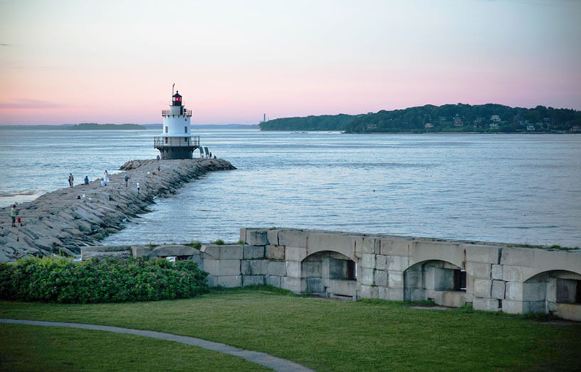
Fort Preble, located in South Portland, ME, on the SMCC Campus, has valued historical significance and serves as a piece of critical infrastructure, serving as a breakwater to hold back the waters from the Atlantic. We take great pride in the fact that with the Fort, we are home to sections of the Spring Point Shoreway Trail and the Greenbelt Walkway, which offer stunning views of Casco Bay and a unique connection to our coastal heritage. It is important to note that this infrastructure has and will continue to change due to storms and natural erosion that has taken a toll on the Fort and both trails.
This page serves as an informational resource about Fort Preble, detailing its history, construction materials, and the efforts to preserve this historic landmark and the remarkable trails across our campus. Whether a history enthusiast or a visitor, we hope you enjoy the spectacular attractions on our campus.
Letter from our President
Dear SMCC Community, Neighbors, Friends, and Families,

I am writing to update you on the Fort Stabilization Project and our ongoing efforts to address the winter storm damage affecting the Fort and Shoreway.
Our commitment to maintaining the Fort and the Greenbelt Walkway is unwavering. We recognize their importance to our community as historical landmarks and beloved recreational spaces. The recent storms, particularly the major winter storms, have caused significant erosion and damage, impacting both the structural integrity of the Fort and the safety of the pathways.
We understand the emotional and historical value the Fort and Greenbelt hold for our community. Our primary focus is to ensure public safety while preserving these historical sites. Although repairs are necessary, they come with substantial financial and logistical challenges. We are dedicated to exploring all possible avenues for funding and support to carry out these essential repairs.
We are committed to maintaining a Greenbelt Walkway accessible to the public. Safety is our top priority, and we have implemented temporary measures to redirect the pathway away from the most affected areas. A new route has been established to ensure continued safe access, and we have provided a map highlighting these changes for your convenience.
Honoring the historical significance of the Fort is a core aspect of our work and plans for the future. We plan to work with historians, preservation experts, and community stakeholders to ensure that any efforts moving forward honor the Fort’s legacy and its historical integrity.
We encourage the public to explore the greenbelt and take note of the reroute designed to avoid dangerous obstacles created by the recent storm. As you enjoy the area, please pay particular attention to the newly installed interactive signage, which provides valuable information about the storm damage, future plans, and important considerations regarding rising ocean levels. This is a unique opportunity to learn more about the challenges our community faces and how we are planning for the future.
We value the support and engagement of our community in these efforts. There are several ways you can contribute, whether through donations, volunteering, or spreading awareness about the project. Your involvement is crucial in helping us achieve our goals and ensuring the Fort and Greenbelt Walkway remain cherished parts of our community.
Respectfully,

Dr. Kristen Miller
President, SMCC
FAQ’s About the Fort Preble Stabilization
Why is there a new route on the pathway?
The new route on the Spring Point Shoreway Trail has been adjusted due to the removal of the stairs that previously guided visitors over the top of the Fort Preble bunker. These stairs required repairs that were not feasible within the current budget, as priority is being given to maintaining SMCC’s student-centered facilities and overall campus infrastructure. The shoreway trail remains open, and new signage directs visitors around the bunker via Bunker Lane to Fort Road, where they can either view the fort wall and lighthouse or rejoin the trail near the pier. In the future, a striped crosswalk path will be added in this area, as Bunker Lane does not have room for a sidewalk.
What is happening with the stairs?
The two staircases leading to the top of the bunker have been removed because the necessary repairs were not feasible within our current budget, given the priority to maintain SMCC’s student-centered facilities and campus-wide infrastructure. Additionally, the design of the Fort has led to natural erosion on top of the bunker, leaving insufficient ground to properly reinstall the stairs. There are also noticeable signs of sinking and erosion on and around the bunker roof.
What has been fixed?
SMCC commissioned the Fort Stabilization Project, initiating repair work on Fort Preble to address immediate safety concerns caused by storms and erosion. Contractors focused on repairing the seawall, walkways, and other affected areas, ensuring that the fort remained safe and accessible for students, staff, and visitors. That project was completed in November of 2023.
Why hasn’t anything else been fixed yet?
Currently, there are no plans or available funds to invest in the fort wall. Addressing the repairs for the stairs and bunker would require a significant amount of unbudgeted funds, which are prioritized for the maintenance of SMCC’s student-centered facilities and campus-wide infrastructure. Conducting a safety assessment of the bunker will incur considerable costs, and the repairs themselves would require a substantial financial commitment.
Who is responsible for the repairs?
SMCC is responsible for significant repairs to any impacted areas. We are honored to be in this historic space and are committed to being good stewards, however our primary mission to improve the lives of students through education and training is our top priority. This informed our decision to redirect the shoreway trail instead of moving forward with very expensive repairs.
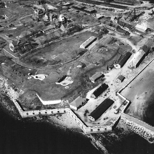
When were the bunkers at Fort Preble built?
The bunkers at Fort Preble were constructed in the early 1800s, specifically starting in 1808. This fort was part of the national defense strategy to protect the United States’ coastlines during periods of conflict, such as the War of 1812.
What materials were used to build the bunkers?
The bunkers and powder magazines at Fort Preble were primarily constructed using thick masonry, including stone and brick. These materials were chosen for their durability and ability to withstand both natural elements and potential explosions. Non-sparking materials like copper or brass were used for internal fixtures to prevent accidental ignition of stored gunpowder.
What are the likely causes of degradation of the bunkers and fort wall?
- Natural Erosion:
The coastal location exposes the structures to constant wind, rain, and salt spray from the Atlantic Ocean. This environment accelerates the weathering and deterioration of the stone and brickwork. Additionally, the shoreway trail beneath the pavement is eroding, which endangers the recently replaced fence and utilities to some mission-critical academic buildings along its edge. - Severe Storms:
Recent severe storms, such as the one on December 24, 2022, have caused significant damage to the fort. High winds and heavy rains can dislodge stones, cause flooding, and further erode the structure’s foundations. - Aging Materials
Over time, the original construction materials naturally degrade. Bricks can crack, mortar can crumble, and the overall structural integrity can weaken, especially without consistent maintenance. - Vegetation Overgrowth:
Unchecked vegetation can grow into and through the masonry, causing additional damage as roots expand and contract.
How much will it cost to do these repairs?
It is hard to determine the work needed to bring the fort to safe standards without a full assessment. This assessment alone would cost thousands of unbudgeted dollars, diverting student-centered facilities and campus-wide infrastructure support.
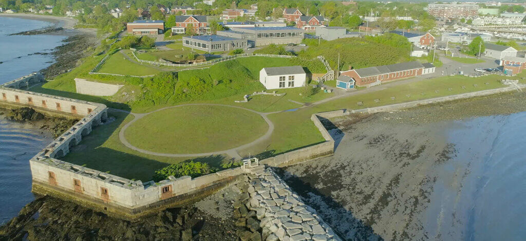
History of Fort Preble
Fort Preble, one of Maine’s most historic installations, was built in the early 1800s to defend Portland Harbor during the War of 1812. The Fort was named after Portland native Commodore Edward Preble, a naval hero who served during the Barbary Wars. Over the years, the U.S. used Fort Preble for a variety of military purposes, including as a training facility for soldiers during World War II. The Fort was deactivated in 1950 and in 1952, the State of Maine obtained it and converted it into a facility for the Maine Vocational Technical Institute, which ultimately became SMCC.
The Fort is also a breakwater for Portland harbor. A breakwater is a structure built along a shoreline to protect boats and ships from the force of waves and currents. It is typically made of large rocks or concrete blocks and is designed to absorb the impact of the waves and redirect their energy away from the harbor or marina. Additional construction began in 1837 after a severe storm destroyed wharves and houses along the Portland/South Portland shoreline.
Questions?
Email smccask@mainecc.edu.